Samples
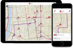
- Infomobilit├® : Discover the website
- ADP : traffic information for Ile de France region and managment of winter road –┬Ā Video
Keywords
- Passengers informations / travel time
- Mobility / Trafic / Parking / Roadworks / Highway road / Winter viability
- Real time information
- Web mapping / Web GIS
- ArcGIS Server – Flex (ESRI) / EventGeo Server / REST
- Geoservices ; WMS, WFInformation voyageurs / Temps de parcours
Description
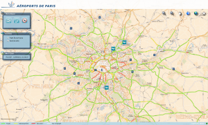
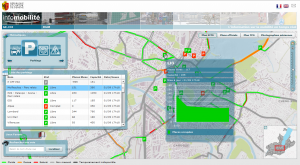
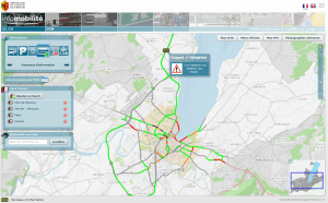
For over 10 years, arx iT develops skills in the managment of spatio-temporal data, particularly┬Ā in real time. For example, the┬Ā“Infomobilit├®” web site, developed for the Canton of Geneva, Switzerland, provides real time information about traffic on major roads. This interactive mapping web application (web GIS) has been developed with ESRI ArcGIS Server technology (REST / Flex API). Another example is the website developed for “A├®roport de Paris” that also shows real time traffic conditions on the Ile de France region. This interactive application shows travels time and winter viability information.
Specifications
- Interactive mapping interface
- ArcGIS Server Flex API / REST / ArcSDE / Oracle
- Data available in real time (24H/24)
- French and English bilingual website
- Data available: Traffic, Parking, cameras and roadworks
- Historical data stored and analyzed with Oracle
- Processing software developed in JavaInformation sur le trafic et sur la mobilit├®
arx iT on social networks